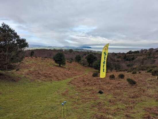
Provisional results: Provisional Results - QOFL5 Quantock North - 29 Jan 2023
Routegadget: Routegadget 2
How did you you find your course? Did you get back before the rain?
Provisional results: Provisional Results - QOFL5 Quantock North - 29 Jan 2023
Routegadget: Routegadget 2
How did you you find your course? Did you get back before the rain?
It was certainly great to get out onto The Quantocks in mostly good weather (unless you were a late starter!)
This event is pretty much the first time I have orienteered in a forest location for a second time (one of my first events was St Audries), and that extra bit of knowledge did help. I had a good start to control 1 (mostly because it was downhill), but with blisters from the day before and tired legs - the climb to 2 was a killer.
I went over the earth bank without realising, and the contours did not feel right so I was looking uphill rather than down, and I did not notice the mapped trees and so missed control 2 (I also did not pace count which did not help). I realised my error and looped back - easily finding the earth bank from the path.
I found some decent animal tracks through the vegetation connecting up 2, 3 and 4 - but my legs were done, so I was walking more than running. I picked up a bit more speed on the path legs to 5 and 6.
I was a bit off cutting to 7, and got distracted by other runners and the faint path near 8 to go off in the wrong direction (although I see from RouteGadget the other two runners who have uploaded their tracks did the same).
The rest of the course was slow but fine (other than missing my turn heading towards 8).
It was lovely being out with such wonderful views but I definitely need to recover some fitness if I plan to do multi-day events any time soon (like in 3 weeks when I head to Portugal ![]() )
)
Thanks to Steve and Mike for planning and controlling, and for Karen, the Craddocks and all the other helpers for putting on a well organised event as ever.
Phil - don’t worry too much about fitness for Portugal - think accuracy is more likely to be needed! Slow and steady are often more productive in the technical events. Also - the area hasn’t got the Quantock steep hills. We’ ll see…
@RosieW that is reassuring!
I did get some rain while out on the blue course but left before the cloud came down. Before that visibilty was good and on this sort of area you can generally see someone in the distance but have no idea if they are on the same course or not so it can be distracting and lead to rash decisions. However it makes a nice change to get such lovely uninterrupted far reaching views. #1 was steep down and steep up. I avoided the path and chose a more daring route going almost straight down but that was slow as I was always braking and trying not to get out of control. At the bottom I was confused to find a gate and fence that was unmapped. As it was an old fence I had expected it to be mapped so lost a bit of time convincing myself that I hadn’t drifted off course. Then after #4 I decided to go on a direct route which was slow as there was a very steep hill to go straight up on the way. Later whenb sat down at home I realised that there was a more efficient route going back up and around thereby reducing the climb considerably, although looking at Routegadget and other runners that did choose that route they were not always faster which I hadn’t expected. Next issue was the route to #6. Someone I had just caught up with took the safe route and went straight up the hillside but I didn’t want to follow them so decided to contour across the hillside but it looked covered in gorse and heather but then I noticed a small animal path going in the right direction and starting further down the valley, but when I got to where I thought it was I couldn’t find it again. So now I had to go even futher up hill in deeper gorse and heather which was painfully slow. After that all seemed to go well and of course the wonderful downhill finish is where I forgot the pain of all the uphill sections. Well done Steve I’m sure your strategy of the downhill finish was welcomed by everyone.
Planner comments from Steve Robertson:
The only negative of this event was that I had not realised the extent of landowner management (the many areas of mown moorland) and the ongoing encroachment of the gorse, both of which required map updating.
Fortunately, until the late rain, the weather was favourable and there was no low cloud that often envelopes these hills and would have made the orienteering more of a navigational challenge.
Thanks to all for their positive comments and most competitors seemed to have enjoyed their runs despite the climb involved.
Planning on this highly contoured area is a challenge. All the courses were within BOF guidelines for length and above the guideline after adjusting for the climb involved. However, after considering the speed of competitors at a previous event on this area the expected winning times looked reasonable.
On Sunday, apart for the Yellow and White, the times of the leading runners were about 20 percent below those expected. I suspect, the fitter competitors were able to capitalise on the track/path network and the mown areas, despite the climb involved.
Thanks to Karen for her quiet, competent organisation, Mike for his controlling help, Bill for his mapping support and DEVON for loan of their equipment (QO kit used for the prior day UKOL event).
Organiser comments from Karen Lewis:
Thank you to all that turned up for this event.
For organising, it is a great area – plenty of parking, decent area for reception and download, so not too much to fret about.
The weather was kind to us until about 1300 hrs, it then started to rain and a mist developed which reduced visibility considerably. The rain did pass over by end of play and thank you to those helpers that stayed behind to assist with control collection. Hope you didn’t get too cold.
Thank you to all the helpers for making the day a success and making my job that much easier. Extra thank you to those helpers that did a full day at the urban on Saturday and still helped on Sunday - your dedication is much appreciated. Also a big thank you to Roger and Judy for getting there early and doing what they do.
Feedback received from competitors was generally all positive.
Well done to Steve for the planning and a special mention for Mike Anderson for his first foray into controlling – he put his all into it.
Hope you all enjoyed your run – until next time.
Short Green here! Climb to #1 relieved by response to Lt Green competitor with 90degree error! Poor route choices to #2 and #6 but otherwise found the map very accurate. Annoying to see competitor directed to correct thicket at #5 when pleased with my own navigation - especially when they then overtook me on the next steep climb to #7. What a great downhill finish - dangerous at my age when upper bodygets ahead of legs!
Disappointed not to acheive Standard after enjoying run.
Thanks to mapper/planner and other officials for good day out.
Couldn’t get to the event, but love the area, so printed a Green route map off Routegadget and walked it yesterday. Quite pleased with my time- but I go super-slow on slopes, up or down, or when high-stepping through undergrowth. Not having control flags in place means you need to navigate precisely, and the absence of other competitors- possibly on different routes- meant there was less distraction. Some lovely little control sites in tree roots, liitle gulleys half way up hillsides, etc. Winter vegetation and the cleared areas have changed parts a lot- but I still got a bit tangles in knee-deep furze. Stopped for five minutes watching 8 stags in a group at the north-most end. Always a joy. Thanks as ever to those who set it all up. And to those control collectors who left tiny inconspicuous twists of ID tape- thank-you! Appreciated…