I’ve enjoyed putting this together as a result of my lengthy mapping project- I hope those that do run one of the courses ( or more if they fancy) also enjoy the experience and provide some feedback afterwards ( good or bad- I can learn from either) as I have other areas under consideration for similar events in the future if this proves a success.
I jogged around a 3 hour course last week to test the MapRun functionality and scoring and managed to visit 19 of the 40 controls on one of the two map sides only- getting them all will be a challenge for the best of the 4 hour participants
I look forward to hearing your comments
2 Likes
First customer feedback from Nicholas Maxwell ( with his permission to post here):
Hi Andy
Thank you for doing the LongO map. It worked really well and I had a very enjoyable morning. It was good to be able to see features eg pits/ depressions due to raised features around them and in all cases see the feature before my phone beeped. Generally I found animal tracks to get across across country.
I entered the 4 hour score because I wanted to cover a lot of the NE map and I correctly worked out I would need the time. In fact, it was just about on 3 hours when I got to 602 and headed for the finish. It took me longer to get back than I expected even though I was mainly on the road - but I made it back in time.
My mistakes were 208 – not initially realising there were two gulleys
304 – taking the wrong path through missing the sharp turn when crossing the river. At least the buildings could be seen
403 to 503 I descended from 403 then decided I had missed the path heading south so contoured along the hill to pick it up. The vegetation was bad and my route was determined by poor animal paths. Eventually, I realised I had to descend to the river. This was my biggest mistake. I found the ruined wall to near 503 but decided to navigate direct. This was a mistake as the bracken obscures the lower section of gulley and I was not high enough. I found the wall again and could then see the upper gulley.
I will try the NW map in due course.
The weather was cloudy with mist on the tops and drizzle between 503 and 752. I was grateful the sun did not come out.
Kind regards
Nicholas
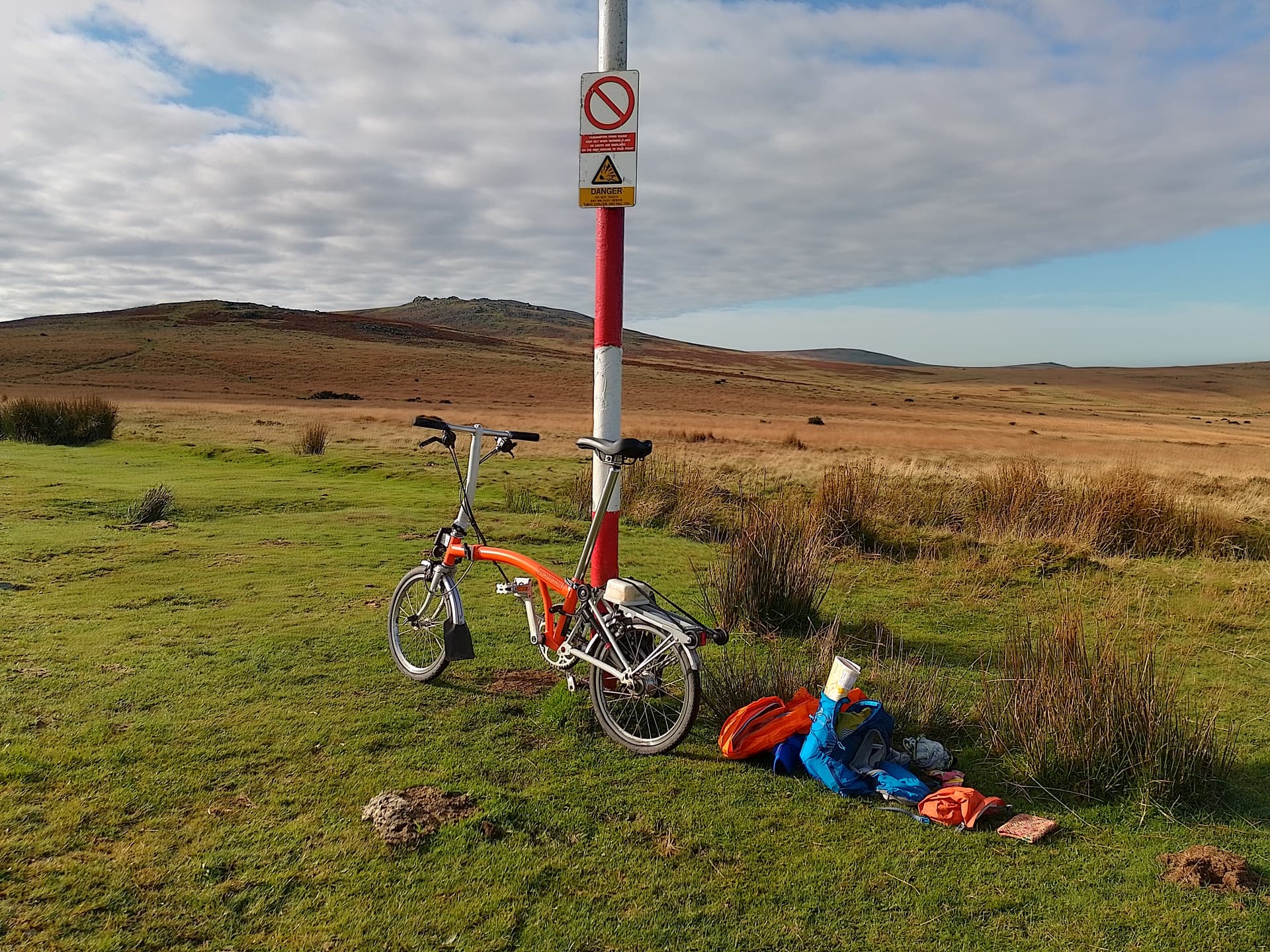
On a rare sunny Friday I headed down to Dartmoor for my attempt. I’d bought a copy of the peculiarly plasticky map a few weeks earlier without knowing if I’d ever have a chance to do it but the opportunity did arise. So I took the train to Okehampton with my folding bike and pedalled the short but steep distance to the start. Then found I had forgotten my compass.
My strategy for the best way to use the 4 hours was to go for the big scores, and so headed around the map edge clockwise, leaving the busier areas for the finish. I convinced myself that a compass was unnecessary and navigation would be easy.
No trouble getting started and hearing the phone ping is very reassuring. The second one I didn’t get straight away, so a bit of searching needed. After a few quick 20s arrived at my first 40 pointer. Only after arriving at 404 I realised to get to 504 I would need to cross a river, and after heavy rain that crossing would be dodgy. I went down and had a look but it was a no go until there was an obvious ford upstream. So a really indirect route. I didn’t notice I forded close to a 30 and left this out, which was a tactical error.
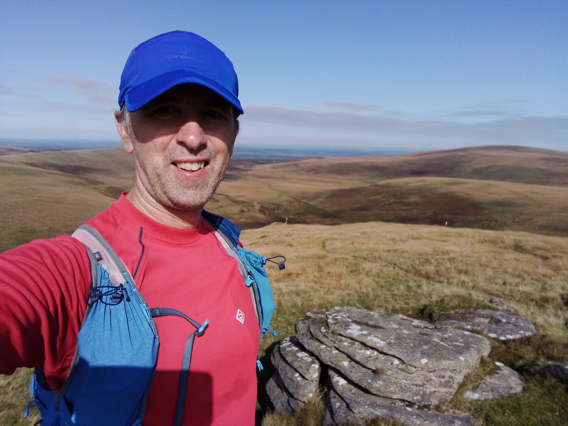
Navigation was fairly easy as I picked off all the controls on the east edge culmnating in the two 75s, then the southern edge 60s to 501 on the western edge. This was quite hard to find, I did a little tour around before I got my ping. I decided that rather than complete the perimeter I would head to the map middle and mop up as many there before finishing.
I came in with 5 minutes to spare and 970 points. So a bit annoyed about missing that 30 point control early on. But it was a great day out and thoroughly enjoyed the whole adventure. And I didn’t need that compass.
Before
During
After
3 Likes